Mountains
Estanys de Malniu: Lake Walk with Turnaround Rules
Walk from Refugi de Malniu to Estany de Malniu with a verified road, fixed turnaround and clear limits for snow, cloud and lake extensions.
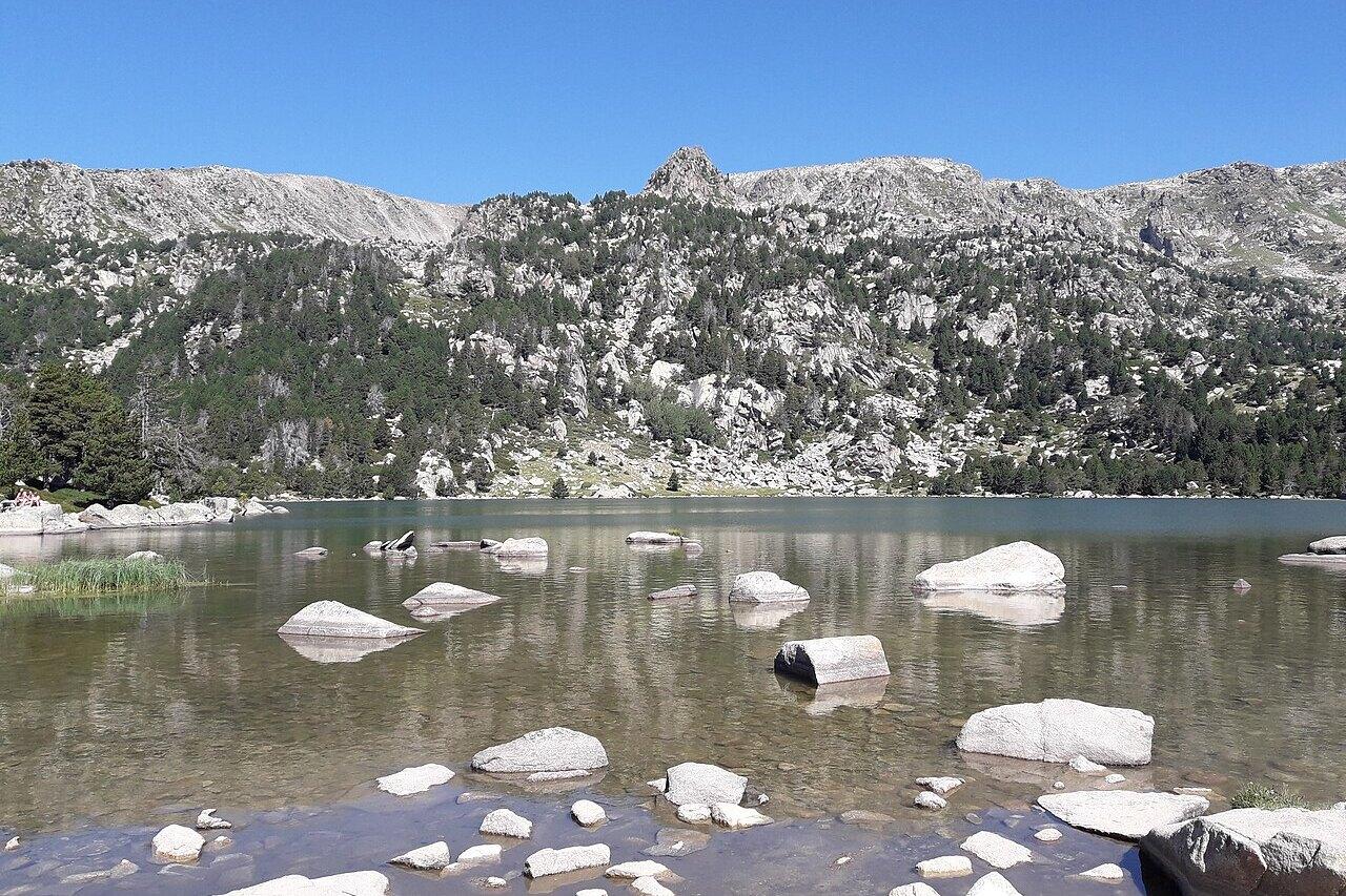
Estany de Malniu is a short walk only after the difficult variables have been removed. The signed route from Refugi de Malniu gains about 120 metres and the official moving-time estimate is one hour return. Yet the start is above 2,100 metres, reached by a mountain track whose status changes, and the path crosses granite, roots and wet ground where cloud, snow or ice can erase the comfort suggested by “very easy.”
Make the main lake the complete objective. Decide before leaving the refuge when the group will turn around, and keep that time even if Estany de Guils appears to be “only another fifteen minutes.” A short high-mountain outing works because the margin is protected, not because every nearby blue patch is collected.
The go/no-go card
| Check | Go only when | Change the day when |
|---|---|---|
| Access | Refugi de Malniu confirms the road and authorized parking are open | The refuge page says the road is closed or conditions exceed the car/driver |
| Weather | No active warning; visibility and storm timing leave a wide return margin | Thunderstorms, strong wind, low cloud or rapid deterioration are forecast |
| Ground | Dry or wet summer trail within the group’s footwear and balance | Snow, hard ice or deep meltwater requires skills/equipment the group lacks |
| Navigation | Official route saved offline; map and phone power backed up | The plan depends on reception or following other walkers |
| Time | Start early enough to return well before darkness and forecast change | Parking, road delay or slow pace consumes the fixed turnaround |
For a dry, settled summer day, allow 2–3 hours at the trailhead, including walking, a lake pause and a conservative buffer. That is deliberately longer than the official one-hour moving estimate. Budget a small vehicle-access/parking fee, food and fuel; the refuge’s current page lists paid authorized parking but shows seasonal figures and live access notices, so check the amount rather than relying on an old screenshot.
The Meranges road is the first mountain section
From Meranges, follow the forest road toward Refugi de Malniu. Do not approach it as an ordinary final kilometre to a visitor attraction. Surface damage, passing space, livestock, dust, runoff and the capability of a low car can all change the drive.
The refuge’s live access page is the decision source. It publishes dated road status, refuge opening periods, authorized parking areas and the vehicle fee. It also warns that the road may close when the refuge is closed. Read the dated notice on the morning of travel and contact the refuge when the wording is unclear.
Arriving at a closed barrier is not permission to park against it or continue around it. The refuge page identifies a walking approach from Meranges and another from kilometre 5, but those turn a short lake visit into a longer hike. Use them only as a separate route planned for the additional time and ascent—not as an improvised response after a late drive.
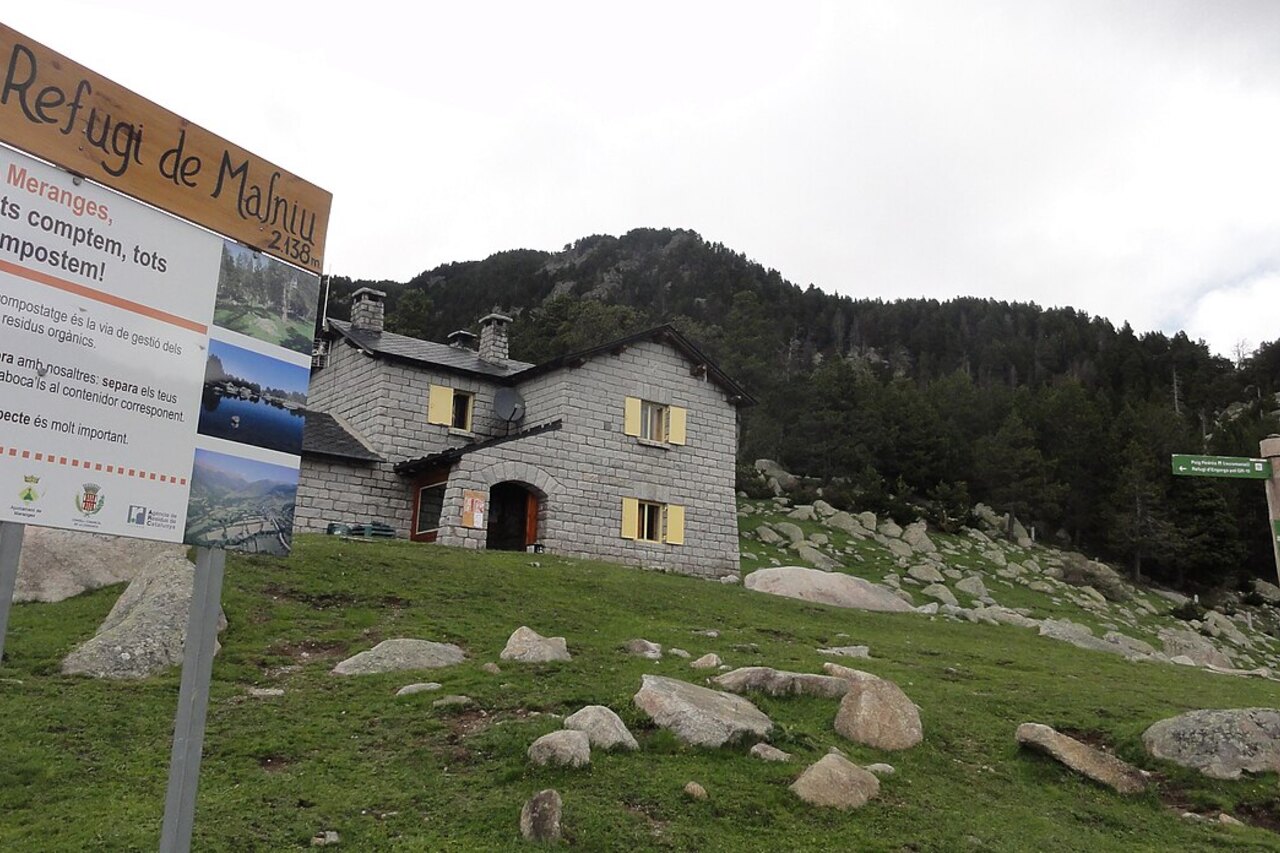
At the parking area, identify the refuge, toilets or services that are actually open, and the precise return point. Pay any access fee as directed. Note the car’s location offline; a crowded summer lot can look very different after other vehicles leave.
Refugi de Malniu to the lake: do not follow the GR 11 forever
The official Cerdanya route begins by the parking entrance near the stream draining Estany de Malniu. It initially follows both the red-and-white GR 11 markings and the white-and-yellow lake-circuit marks through the forest.
The key navigation decision comes after the first climbs: the GR 11 turns right toward Refugi de la Feixa, while the lake route continues left, now following the white-and-yellow marks. Farther on, a signed junction points right toward the lakes. Read the junction signs instead of assuming the broadest or busiest track is correct.
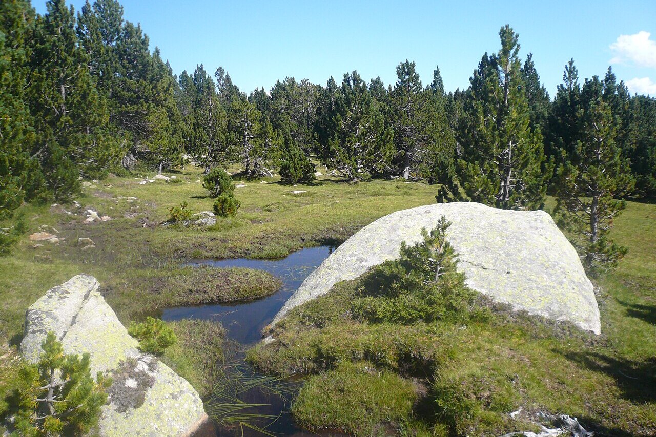
The official figures are 2,250 metres at Estany de Malniu, 120 metres of ascent and about 35 minutes outward plus 25 minutes back. Those are useful for orientation, not a promise. A child, a person unused to altitude or a group negotiating wet boulders may take much longer. Start the turnaround clock from the car, not when the trees finally open onto the water.
Carry water, food, a warm and waterproof layer, sun protection, first-aid basics, a charged phone, backup power, headlamp and an offline topographic route. Shoes need grip on irregular rock. Trekking poles can help some walkers on the descent but do not replace balance or suitable footwear.
Estany de Malniu is the decision point, not the halfway mark
At the lake, stop before circling it. Check the cloud base, wind, group energy, time and whether the return markings are still easy to see. Save enough warm clothing for the pause; a shaded 2,250-metre shore can cool people quickly after the climb.
The water’s edge is sensitive. Keep away from saturated margins and vegetation, pack out all food and tissue, and do not make stone stacks or move granite. Swimming should never be treated as an expected reward: cold water, submerged rock, weather and the lack of a supervised bathing area change the risk. A lakeside lunch is enough.
The name “Estanys de Malniu” encourages extension. The municipal Guils itinerary notes a small seasonal Estany Mal on one approach and an optional continuation from Estany de Malniu to Estany de Guils. The Cerdanya route warns that this continuation is less clearly marked. That is the controlling fact.
Continue only if the exact path is loaded offline, the ground is dry and snow-free, visibility is stable, everyone is moving comfortably and the extension fits inside the pre-agreed turnaround. Otherwise, turn at Estany de Malniu. Do not seek Estany Mal or another water body by wandering toward a visible hollow.
The descent still contains the day’s consequences
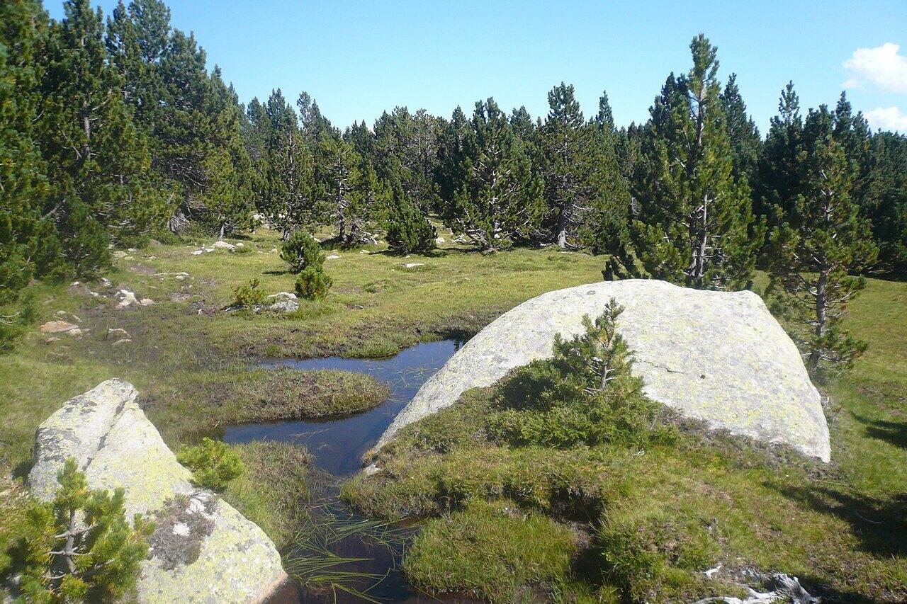
Return by the known marked path. Granite polished by feet becomes slippery when wet; roots and low steps require more attention after a long lake pause. Keep the group together at every junction and confirm the white-and-yellow marks until the shared GR 11 section is regained.
If cloud closes in, do not hurry into a fall. Stop, put on layers, verify the last known location and retrace only the confirmed route. If the markers have not appeared within the expected short interval, return to the last certain point rather than cutting downhill toward an assumed road.
Thunder changes the response. Leave the shore and exposed clearings before the storm reaches the basin; do not wait under an isolated tree or beside metal fencing. The right turnaround is based on the forecast and visible build-up well before thunder is overhead.
Snow makes this a different activity
An official page may describe the destination as year-round and mention snowshoes. That does not convert the summer path into a beginner snow walk. Road closure, buried markings, cold exposure and avalanche terrain require winter planning and judgment.
Before any snow-covered attempt, read the ICGC avalanche bulletin for the relevant eastern-Pyrenees zone and the Meteocat Pyrenees forecast. A danger number is not permission: the bulletin’s elevation, aspect and avalanche-problem text must be applied to the actual route. If the group cannot do that, choose a managed winter venue or hire a qualified guide.
Microspikes, snowshoes and avalanche rescue equipment solve different problems. Carrying one does not compensate for missing the knowledge required by another. Fresh snow over rock can be awkward with snowshoes; hard ice can make a small slope consequential; avalanche gear without training does not create a safe plan.
When the access road is closed, the forecast is unstable or the first forest section is icier than expected, keep the outcome low. Walk only around an open refuge and Estany Sec if staff confirm a suitable public route, return to Meranges, or choose a valley-floor walk. Estany de Malniu will still be there on a day when the road, weather and group agree.
Related guides
- Puigmal from Vall de Núria: Rack Railway Hiking Plan
A summit-day plan for Puigmal from Vall de Núria, with rack-rail timing, turnaround rules, altitude, and weather fallbacks.
- Gra de Fajol from Vallter: A High-Mountain Route Plan
A conservative route plan for Gra de Fajol from Vallter, covering the Marrana pass, exposure, wind, water, descent, and no-go alternatives.
- Ulldeter Refuge from Vallter: A First High-Mountain Walk
Walk to the current Ulldeter refuge from the Vallter road, with a clear turnaround, snow-free conditions and a separate longer-route option.
Are you in the know?
Receive new articles, local updates, and occasional offers from selected partners. We never share your email address. Unsubscribe at any time.
By subscribing you agree to our privacy policy.